| Zeitangabe | Verwaltungsereignis | Quelle |
|---|---|---|
| 1994: | eingemeindet nach Jöhstadt |
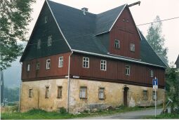
Siedlungstyp: Dorf, Landgemeinde
| Zeitangabe | Bevölkerungsangabe | Quelle |
|---|---|---|
| 1789: | 1 besessene(r) Mann, 6 Häusler | |
| 1834: | 254 | |
| 1871: | 321 | |
| 1890: | 320 | |
| 1910: | 275 | |
| 1925: | 360 | |
| 1939: | 333 | |
| 1946: | 489 | |
| 1950: | 444 | |
| 1964: | 334 | |
| 1990: | 237 | |
| 1834: | Römisch-Katholisch 4 | |
| 1925: | Römisch-Katholisch 20 | |
| 1925: | Evangelisch-lutherisch 296 | |

| Zeitangabe | Verwaltungszugehörigkeit | Quelle |
|---|---|---|
| : | Amt Wolkenstein | |
| : | Amt Wolkenstein | |
| : | Amt Wolkenstein | |
| : | Gerichtsamt Jöhstadt | |
| : | Amtshauptmannschaft Annaberg | |
| : | Landkreis Annaberg | |
| : | Landkreis Annaberg | |
| : | Erzgebirgskreis | |
| Zeitangabe | Grundherrschaften | Quelle |
|---|---|---|
| : | Amtsdorf | |
Kirchliche Organisationen
nach Grumbach gepfarrt 1752 u. 1930 - 2001 zu KG Jöhstadt
| Zeitangabe | Ortsnamenform | Quelle |
|---|---|---|
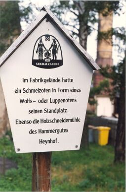
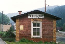
| : | Schmalzgruben | |
| : | Schmaltzgrube | |
| : | Schmaltz grube | |
| : | In der Schmelzgruben | |
| : | Schmalzgrube |
| nix | Literatur | Quellen |
|---|---|---|
| HONB II 366 | ||
| Dehio Sa II 417 |
Historische Karten
Verwaltungsgrenzen
Historische Luftbilder
Deckkraft Overlays
100%Weitere HOV-Orte in dieser Stadt/Gemeinde (8): Bottendorf Grumbach (2) Jöhstadt Neugrumbach Oberschmiedeberg Schlössel Schmalzgrube (1) Steinbach (5)